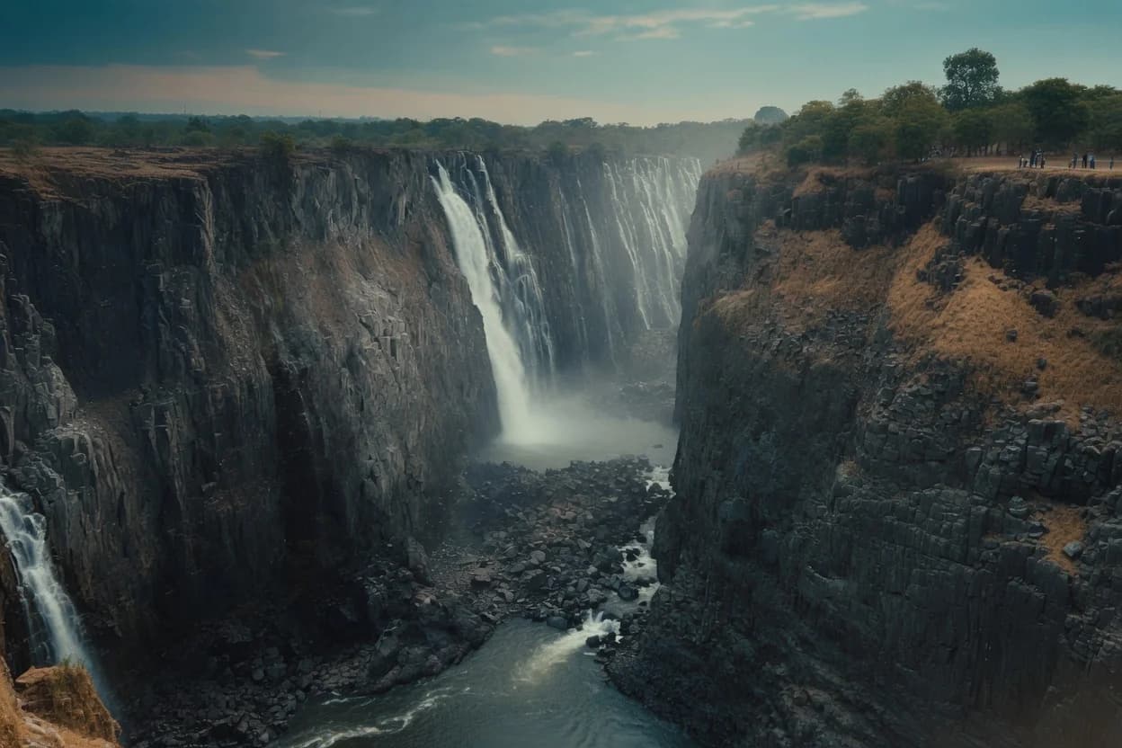
November flow is about a tenth of April's. The Zambezi does this every year — and in 2019 the world reported a season as a catastrophe.
In November the basalt shows. Stand at the Zambian end of the chasm late in the year and you are looking at a wall of dark wet rock with water at one end of it, and if that is the only photograph you have seen of Victoria Falls, you would be forgiven for thinking something had gone badly wrong.
Nothing has. The Zambezi does this every year.
The river peaks in April and bottoms out in November, and the difference between those two months is not a matter of degree. November flow is around a tenth of April's. That is a bigger seasonal swing than almost any other major waterfall in the world, and it is the single fact that explains every argument anyone has ever had about when to come.
At full flood the Falls carry something in the order of 500 million litres a minute across a curtain 1,708 metres wide, dropping 108 metres into the First Gorge. The highest flow on record, in 1958, was closer to 700 million. At the other end of the year the same lip of rock is running a fraction of that, and between September and January up to half the rock face can be dry.
Both of those are Victoria Falls. Neither is the real one.
This is the part the photographs never explain, and it is the part that actually matters when you are choosing where to stand.
The Falls are not one sheet of water. They are four cataracts strung west to east along the chasm: Devil's Cataract, Main Falls, Rainbow Falls — the highest of them — and the Eastern Cataract. The first three sit on the Zimbabwean side. The Eastern Cataract is Zambian.
The lip is not level. The Zambian end sits higher, which means it is the first to run thin and the last to fill. In a normal low-water year the Eastern Cataract slows to almost nothing and in places stops altogether. That is routine. It happens most years. Meanwhile Devil's Cataract, at the western end, is still going, because that is where the deepest channel is.
So the practical answer to is: on the Zimbabwean side, yes, in every month. On the Zambian side in October and November, often not much.
Like the look of this?
At the end of 2019 the story went round the world that Victoria Falls had dried up. The photographs were real. The framing was not.
They were taken from the drier Zambian sections, at the seasonal low, and published without mentioning that the river has a seasonal low. The Zimbabwean side, still running, largely did not appear. Zambezi River Authority figures put the flows close to the lows of 1995 and 1996 — genuinely low, and part of a pattern that also includes 1914, 1948 and 1995 — and by the time the story reached its widest audience the levels were already climbing again.
Sources still disagree on how bad it was. Some accounts describe it as the lowest flow in a century; the Zambezi River Authority's own record puts it near the 1995–96 mark rather than beyond it. We have not been able to reconcile the two, and we would rather say so than pick the more dramatic one.
The correction can be pushed too far, and plenty of people in the tourism business have pushed it.
2019 was a real drought. The Zambezi basin has had a run of poor rainy seasons, hydropower output at Kariba has suffered for it, and the long-term concern about rainfall in this catchment is not manufactured. Anyone telling you the low-water story was pure invention is selling you something too.
And low water genuinely does cost you something. If you want the wall of white, the roar you feel through your feet, the spray column visible from thirty kilometres — that is April, and no amount of context makes October the same experience. On the Zambian side in November there are stretches where the honest description is a dry cliff.
Two things are true at once: the river has a dramatic annual cycle that gets misreported as collapse, and the collapse everyone worries about is not an unreasonable thing to worry about.
Practical, so no decoration.
February to May — high water. The full curtain. Also the most spray, which means viewpoints disappear into cloud, cameras get soaked, and you will see less of the actual rock. April is the peak. Rafting is closed through most of this window; the river is unrunnable.
June to August — falling. For a first visit this is the compromise most people want: enough water for the curtain to read as a curtain, little enough spray to see it. Rafting reopens.
September to November — low water. The clearest views of the structure, the best rafting of the year, helicopter flights that actually show you the geology. The Zambian side thins out and Devil's Pool opens on the lip. Operators quote different windows for the pool — mid-August through December is the usual claim, but it is set by the water, not the calendar, so confirm before you build a trip around it.
December to January — rising. Quiet, green, unpredictable, and cheaper.
The mistake to avoid is not picking the wrong month. It is picking a month for the waterfall when the waterfall was never the reason you were coming — most people who visit the Falls are really there for the river, the gorge and what sits upstream, and those are good in every month of the year.
Upstream of the Falls the Zambezi is a different river entirely: wide, slow, island-studded, with none of the noise. Royal Chundu sits on that stretch about 30km above the lip, on the Zambian bank, and it is the property in our collection closest to this piece — the water outside it is the same water, three days earlier.
The rest of the collection is inland in Hwange, which is a different trip on a different clock. For how the two fit together across a year, our seasonal guide to Zimbabwe and Zambia covers the wider calendar; this note is only about the water.
Flow figures are drawn from Zambezi River Authority records as reported in published accounts, and from operator and encyclopedic sources cross-checked against each other where they agree. Where they do not, we have said so. Water levels vary year to year and no month guarantees a particular volume.
